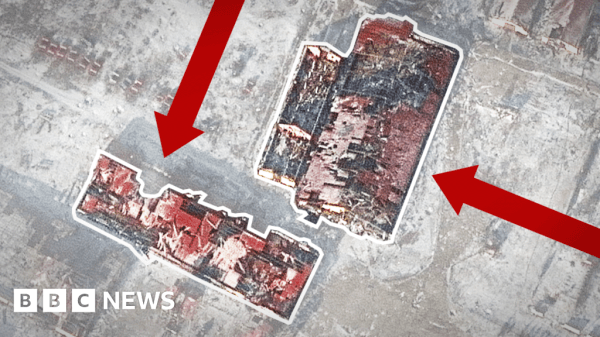
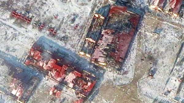
Image source, MaxarImage caption, Fighting around Soledar in eastern Ukraine has left many buildings in the town in ruinsBy The Visual Journalism Team BBC News
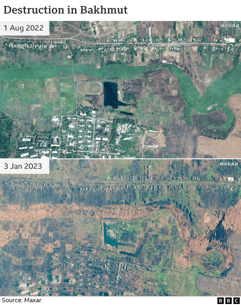
The destruction caused by fighting between Russian and Ukrainian forces battling for control of a town in eastern Ukraine has been revealed in newly released satellite images.
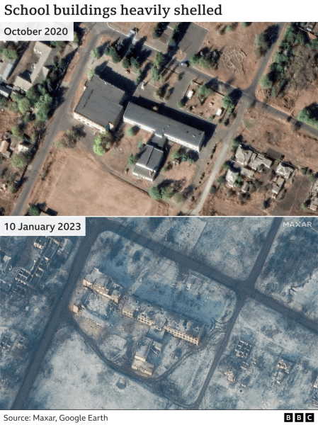
Comparison with earlier images shows a school and several agricultural buildings are among the structures destroyed in Soledar, while bomb craters scar the landscape and roads around the salt-producing town in Donetsk.
Your device may not support this visualisation
Much of the damage has been caused in recent weeks with Russian forces trying to seize the town, after months in which they have failed to take a single key town or city in Ukraine.
The strategic significance of Soledar is disputed by military analysts but if Russia succeeds in establishing full control over the town it would be a symbolic victory for the Kremlin.
Russia's notoriously brutal Wagner mercenary group has been heavily involved in the battle for the town, with its head Yevgeny Prigozhin at one point claiming his fighters were in full control and that only his troops took part. However, Russia's defence ministry has insisted its forces are involved.
Ukraine's defence ministry said on Wednesday that heavy fighting continues, and Wagner forces have had no success in breaking through Ukrainian defences.
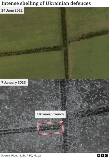
The images released by Maxar, a US-based space technology company, show how Ukrainian trenches in fields around the town have been targeted by Russian artillery.
Success in Soledar may help Russia in its assault on the Ukrainian city of Bakhmut, about 10km (6 miles) to the south west, providing it with a secure artillery position within range of the city.
The town also has deep salt mines, which could be used to station troops and store equipment, protected from Ukrainian missiles.
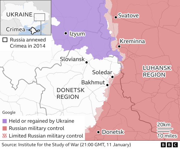
Taking Bakhmut would be a "much needed boost for Russian forces in the east who have been under real pressure since September", says Edward Arnold, from the Royal United Services Institute (Rusi), although he adds it would have "little strategic significance for the outcome of the war".
The city has itself been devastated by months of fierce fighting, with Russia continuing its assault there even as its forces were pushed back elsewhere in Ukraine.
-
Conflicting claims over embattled Ukraine town
- 1 day ago
-
Ukraine battle hints at rift in pro-Russian forces
- 22 hours ago
-
Why the battle for a Ukrainian salt town matters
- 18 hours ago
-
Defying Russia in the city 'at end of the world'
- 4 January
-
Five ways Ukraine war could go in 2023
- 27 December 2022
Source: bbc.com

